
Skip to content
Gardenly3D

Site Survey

Bring the real garden into every design decision

Capture observations, measurements, photos and existing conditions, then keep that site evidence available inside the same garden project.

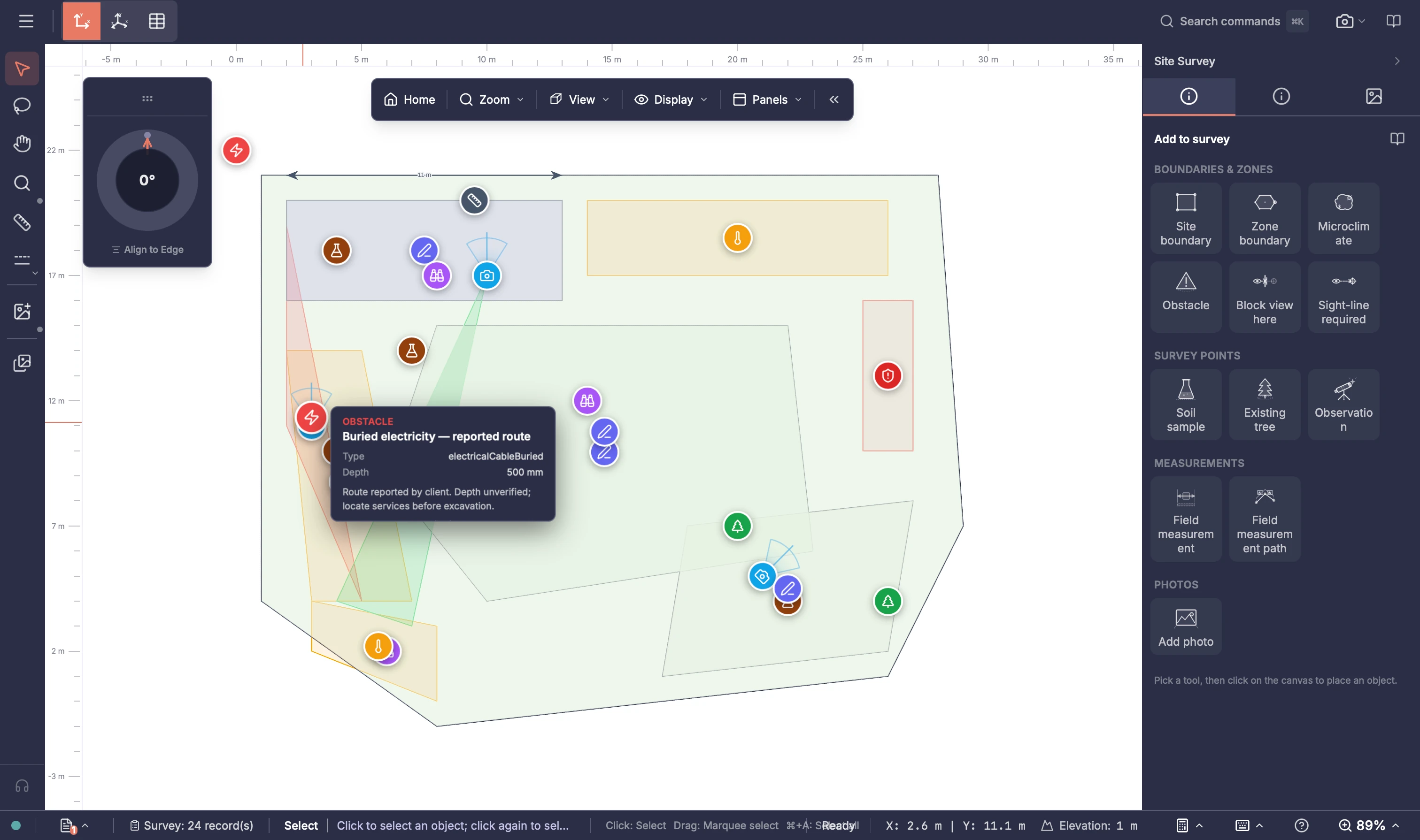
Site Survey showing garden boundaries, zones, soil samples, photo positions and a reported buried electricity route

Connected site context

Keep site-visit information with the project

Record site conditions during or after a site visit, place them in context on the survey canvas, and return to the structured information while the project develops.

  1. 01

    Record on site

    Capture supported observations, measurements, photos and existing conditions.

  2. 02

    Place the evidence

    Organise survey records spatially on the site and retain their source context.

  3. 03

    Use it while designing

    Return to relevant site information as the drawing, terrain and analysis develop.

  4. 04

    Report what was found

    Generate a supported Site Survey summary from the selected project records.

Professional site records

Why use Site Survey?

Keep different kinds of site information organised, make its origin visible and review photos in relation to the site.

Structured records

Keep different kinds of site information structured

A site visit produces measurements, observations, photos and notes that can become difficult to find and compare when they are scattered across general-purpose files and apps.

Site Survey gives supported site information a defined record type and a position in the project, so existing conditions can be reviewed together without flattening everything into one long note.

In practice

  • Separate boundaries, existing trees, soil samples, obstacles, microclimates and observations
  • Use fields suited to each supported record type
  • Review the records together on the survey canvas
Source and confidence

Know how each record was obtained

A measured dimension, a client-reported value and information inferred from a photograph do not carry the same level of confidence. If that origin is lost, a value can appear more certain than its source allows.

Keep the capture method, confidence, date and optional source reference with the record, making its context easier to understand when the project is reviewed later.

In practice

  • Distinguish measured, estimated, client-reported, open-data and inferred information
  • Record a confidence level, date and optional person or source reference
  • Keep the information as designer-managed project records

Photo context

Review site photos in context

A folder of site photos shows what was seen, but not always where it was seen or which way the camera was facing. That context matters when the design work begins.

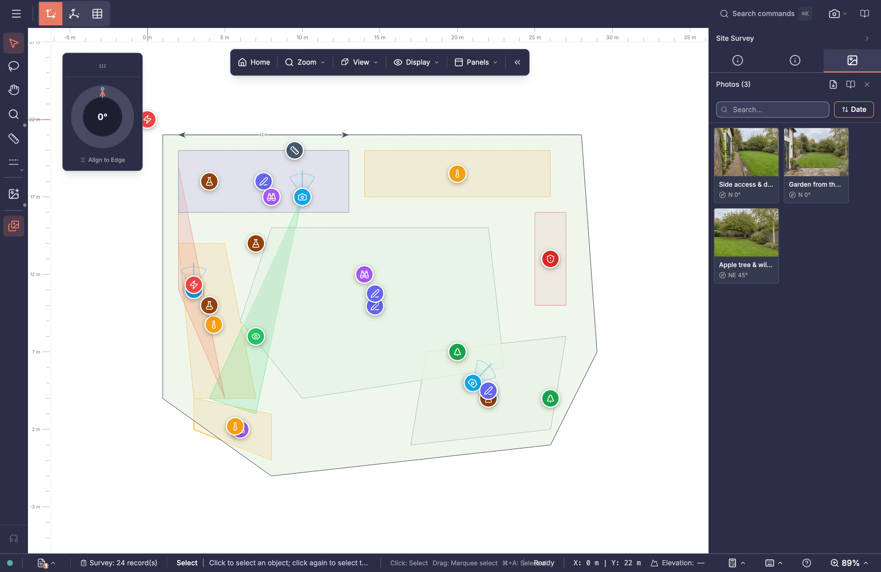
Keep supported photos with the survey, find them in a searchable gallery and use available direction and field-of-view information to relate them to the site.

In practice

  • Search and sort the projectโ€™s survey photos
  • Review supported direction and field-of-view information
  • Create a single-page PDF photo board

Capability detail

Site Survey capabilities

Record the existing site

Keep observations about the real garden organised by record type, making the site information easier to find and review.

Boundaries and zones

Draw a site boundary and internal survey zones on the canvas.

Microclimates

Mark sun traps, frost pockets, rain shadows, wind funnels, shade, damp or dry areas.

Existing trees

Record tree identity, dimensions, crown spread, condition, intended action and supporting notes.

Soil samples

Record supported soil-sample details such as depth, pH, texture, moisture and percolation observations.

Obstacles

Mark observed or reported features the design may need to work around, with optional depth, buffer and reference information.

Site observations

Pin qualitative notes such as standing water, erosion, runoff direction, soil condition or another site observation.

Sight-line requirements

Record a view from a viewer position towards a target that should remain visible.

View blockers

Mark areas where visual screening may be wanted and record an optional height.

Photos and site context

Keep site photographs with the survey and use their available location and direction information to understand what they show.

Site photos

Add JPEG, PNG or WebP photos as survey records, with supported capture information and an optional direction and field of view.

Photo gallery

Search and sort survey photos by date, direction or name, then locate a selected photo in the survey view.

Directional photo context

Review supported photo direction and viewing-angle information with markers and 3D visual context.

Photo board PDF

Create a single-page PDF photo board from the photos in the survey drawing.

Measure, align and review

Record measurements, use reference material and review survey information while retaining its source and confidence context.

Field measurements

Add single- or multi-segment measurement records and enter the measured value, confidence and notes.

Path measurements

Record a walked or multi-segment measurement path when one straight dimension is not enough.

Reference underlays

Add a reference image beneath the survey drawing, adjust its opacity and set its real-world width.

XYZ

2D and 3D survey views

Move between a 2D drawing view of survey records and a 3D view with supported spatial photo context.

Display controls

Show or hide reference information and individual survey-record categories while reviewing the site.

Source and confidence

Record when and by whom information was captured, whether it was measured, estimated, reported, open data or inferred, and its confidence level.

Use survey information in the project

Return to the site records as the garden develops, and prepare survey reports from the information you have recorded.

Useful to know

Site Survey stores designer working records. It is not a replacement for a licensed land survey or a utility-locating procedure.

Continue exploring Gardenly3D